I can’t quite get my head around the fact that I’m standing on terrain that is actually younger than I am.
It’s a concept that changes the way I view the planet, making me think of it more like an evolving, growing entity. I bend down and gingerly touch the dark soil as though it’s something alien; I’m slightly awestruck.
If I’d been in this spot prior to October 1971, someone would be calling the emergency services by now as I’d have been in over my head, battling Atlantic swells.

The route linking the San Antonio Volcano at Fuencaliente and the southern tip of La Palma beyond the Teneguía Volcano, which erupted in 1971 creating a slightly bigger La Palma, is more than just a jolly jaunt through a dark satanic landscape.
It’s a walk through a wondrous world which, relatively speaking, few visitors have set foot on, yet it’s a land that has such power that when some Americans hear the name La Palma they connect it with an apocalyptic tsunami that will destroy their world.
A BBC documentary in 2000 made La Palma infamous with claims that a huge chunk of the island could detach, slip into the Atlantic and send a mega tsunami tearing across the Atlantic. Having interviewed Dr Simon Day, one of the scientists involved, a couple of years ago and heard his less sensationalised version it’s not something I’m going to lose any sleep over. But there’s no denying that it adds spice to walking in a land that has displayed relatively recent volatile tendencies.
Our guide through La Palma’s wild south is journalist, film-maker and author of the walking guide La Palma y Sus Caminos, Daniel Martín Gómez.

The route starts at the San Antonio Volcano near Fuencaliente (or Los Canarios as it’s also confusingly known) where there’s a decent little Visitor Centre and an abstract open air art gallery. San Antonio last threw a spectacular natural fireworks party at the end of 1677. It looks exactly like you want your volcanic crater to look like and has a mini pine forest in its centre.
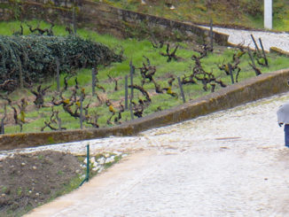
It’s a bit of a detour to enjoy a wander around San Antonio’s rim but the rewards are views along the island’s west coast where destructive volcanic slopes now nurture neat rows of vines, some of which produce the famous Malvasia wines. In the other direction, floating ghostlike on the horizon beyond a ruddy and basaltic terrain, are Tenerife, La Gomera and the tiddler of the Canary Islands, El Hierro.

From here it’s just a seven kilometres gentle descent through cones, craters and unnatural rock formations, the result of the earth’s cooled and solidified spewings, to La Palma’s new world on the coast. There is no shade, so it’s a route where a hat and plenty of water is required.
Whilst the route through a volcanic world is interesting, it’s the end of the road that intrigues me. Here lies a quirky kingdom.
Amidst the ebony lava are small scenes of normality. In between two volcanic arms is a black sand cove where a handful of colourful umbrellas provide shade for a few sunbathers. Daniel tells us that this is location of the thermal spring that gave the area its name, Fuencaliente. The spring was buried by the lava from the San Antonio eruption in 1677/78 leaving Fuencaliente without its spa for over 300 years. Daniel says there are plans to uncover it and set the hot waters flowing again. But when that might happen is as much a mystery as when bits of the island might start falling into the sea.

As well as the few sunbathers, there is a fishing community. Their ramshackle huts with corrugated roofs nestle into the rocks at another sandy cove below not one but two lighthouses whilst their tiny cobalt boats bob happily in a sparkling sea.
Beside the lighthouses lie more quirks, a series of salt pans that keeps the La Palma well stocked with much of its table salt, ensuring the Canarian speciality of papas arrugadas (wrinkly potatoes) are always nice and salty.

There’s something unusual and at the same time reassuring about viewing scenes of normality in such a unique landscape. Like the slopes that are now vineyards, the new land has been used in a productive way. It gives it character otherwise it could just be another rocky formation where we smile and say, ‘very nice’, take a photo or two and turn away to move on to pastures new, in this case maybe not quite so new.
Fuencaliente’s young land stays with you after you’ve left. Maybe because of the notion that not so long ago it didn’t exist and sometime in the future there’s a chance that it will cease to exist yet again.
Fuencaliente Fact-file: The route from San Antonio to the coast is free but access to the Visitor Centre and the San Antonio Volcano itself costs €5. There are also camel rides around the area for around €6.
Conveniently a bus route (L31) links the lighthouses with the San Antonio Volcano. The bus departs from the lighthouse (faro) every two hours from 9.45 to 19.45 but do check that there have been no changes to the timetable otherwise it’s a 6.8 km hike back up the hill. The bus also passes the Hotel Teneguia Princess; very handy for guests.
Buzz Trips strolled through this brave new world courtesy of Patronato de Turismo de La Palma.
Jack is co-owner, writer and photographer for BuzzTrips and the Real Tenerife series of travel websites plus lots of other things. Follow Jack on Google+


Fascinating. Shamefully I haven’t been to La Palma yet (something to be corrected very soon). When I’m confronted with lava beds I usually get the opposite kind of feeling – how it must have looked so long ago as hot lava met “cold” Atlantic and froze in time millions of years ago!
I never thought about how authorities must need to be prepared for new land forming either! Construction of new lighthouses for example must be something urgent.
BTW that scenario about La Palma splitting and causing a tsunami in the US? It was used in an episode of CSI Miami once!
Well I didn’t know that about CSI Miami 🙂
The oddest thing I read about it was on a website that suggested a pre-emptive strike by the USA had been suggested (probably by someone on a forum rather than anyone official) as a way of ensuring there would definitely be no landslide and no tsunami 🙂
Fascinating post, Jack. Annoyingly, the landscape will always be a year older than me. So can’t make the same claim as you when I visit. Which your article has inspired me to do.
Cheers Matthew, thanks for that. It’s an interesting place.