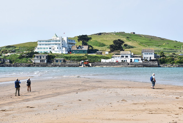
‘Why does anyone need walking directions?’ the man asked as we continued to stare at the channel of churning water that separated us from our objective, a tiny tidal island in South Devon which has featured in at least two Agatha Christie novels.
We’d been keeping an eye on the watery blockade for over an hour, ever since we discovered the path to the island was tide dependent and we, like the man and his companion, had arrived when the tide was high. While we waited, we chatted, both of us learning the reason for the other’s visit. His was leisure and curiosity, ours was work, compiling information for a walking holiday and guide in South Devon. This last revelation was the prompt for his question.
Why does anyone need walking directions? It is a fair question. The obvious and simplistic answer is, so you don’t get lost. But there’s more to it than that.
‘There are plenty of other walkers following the route so it is extremely unlikely that you will take a wrong turn…’
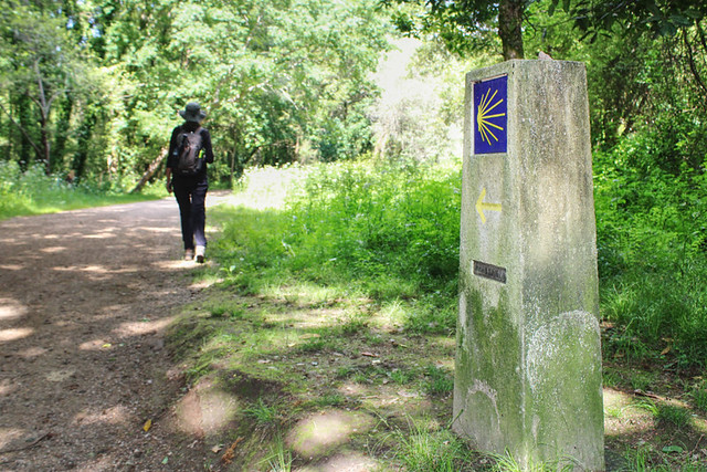
This was a comment I saw recently about walking the Camino Portugués, the spoke of the Camino de Santiago which heads to Santiago de Compostela via Portugal. We helped create a walking holiday there in 2020. The Camino de Santiago is well signposted and thousands of pilgrims, religious and otherwise, walk its various routes every year. It would be difficult to get lost. So, why the need for walking directions on a route as popular as this?
A couple of days ago, we set out on a circuit from our village. We’ve walked all the paths directly around where we live in Somerset, but fancied extending one of the loops, so I carried an OS map with me. If you can read a map, you can find your way anywhere … within reason. Even the best have flaws. Having used maps in various European countries I consider OS to be the cream, but they aren’t perfect. Paths don’t always exist where they should. However, proficiency with a map can usually get orienteers out of most navigational conundrums.
As we climbed through a farm on the ‘new’ section of the route, the farmer warned us the path ahead was overgrown and almost impassable. He advised us to follow an alternative track through a field, assuring us it would meet the original path further up the hill. On the OS map, the farmer’s track didn’t exist, only the public right of way. The track was easy to follow and it would have been good advice except for one thing, it ended in a cul-de-sac of a field. Thanks to the map, I knew where we were and, more importantly, where the path should be. A leap of faith through a nettle-ridden, overgrown bush revealed a gate, and the elusive path. Without the map, I’d have had to retrace my steps. If I didn’t know how to map read, I’d have had to retrace my steps. It is unlikely any visitors to the area, exploring on foot without map or directions, would have found their way to our objective, the summit of a hill with expansive views across Somerset.
Anyone who finds pleasure in yomping across the countryside but who can’t read maps will have a more satisfying and enjoyable experience if they have directions to help them discover the best places.
What about those who can read maps, or are following popular walking routes like the Camino de Santiago?
There’s a training term called unconscious incompetence which is applied to people learning something new. It means they don’t know what they don’t know. Following the Camino de Santiago is relatively easy, but what many people aren’t aware of is there are stretches called complimentarios – deviations through the most scenic aspects of the way which aren’t on the main route. Simply follow the crowds and it’s highly unlikely these would be discovered.
Additionally, walking route directions are more than ‘turn right here, turn left there.’ They also include information about the route – where to eat, where to take little detours, the name of that pretty little chapel and why it’s so unusual, what that strange looking flower is, and so on. They’re guides like any guides. They add depth.
Back to the man waiting at the water crossing in Devon. Before we congregated at the channel, we’d met him previously. In fact, we’d told him what time the tide drifted away, and also when the island’s people-carrying sea tractor made its irregular crossing. We’d already found those things out after discovering the route to the island was impassable – online advice wasn’t fully accurate – so we could include them in the walking directions we were compiling, making it easier for people who used those directions to plan their day more effectively. Also included in those route directions was how to summon a ferryman to transport walkers across the River Avon, when food trucks at Bantham beach were open and what they sold, and how people could make the return trip to the ferryman without scaling a steep hill. All snippets of information our new friend at the water’s edge didn’t know.
People don’t need walking directions, but there’s a good chance they’ll miss out on a hell of a lot without them, that’s if they don’t get lost.


Be the first to comment