Despite having spent a lot of time exploring the Canary Islands, we’ve ignored Fuerteventura. Nearly everything we read concentrated on the beaches. Two years ago we attempted to find out more about some of the towns on Fuerteventura but after a couple of people who lived there more or less said ‘there’s not much to tell’, we weren’t inspired to visit.
This year we felt it was time to find out for ourselves what the island was really like. With some hasty research under our belts (we’d just returned from France) we set off on a magical mystery tour to explore the northern half of Fuerteventura.
Caleta de Fuste
On the afternoon we arrived on Fuerteventura we’d enjoyed a decent tapas lunch of Majorero cheese, croquetes and tiny fried squid in Caleta de Fuste. The town had all the hallmarks of a typical purpose built beach resort. There were nice beaches but it lacked character and there were too many naff looking bars and over-tanned people. Subsequently we gave it a body swerve on our road trip day.
Puerto del Rosario
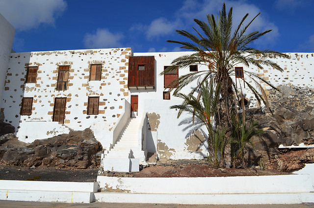
When we reached Puerto del Rosario we felt we were starting to see the real Fuerteventura. The island’s capital doesn’t have the history that some of the other capitals in the Canary Islands have, but it felt real with a pleasingly relaxed vibe. And it boasts good beaches that were free of crowds on a hot weekday in October. It’s also got arty aspirations. A sculpture trail was a good way to get to see the town as well as enjoying a quirky mix of modern and conventional works of art. As a bonus, the girl in the tourist office was a star, helping plan the rest of our day’s itinerary and intriguing us by telling us to look out for ‘skweerels’.
The Drive North
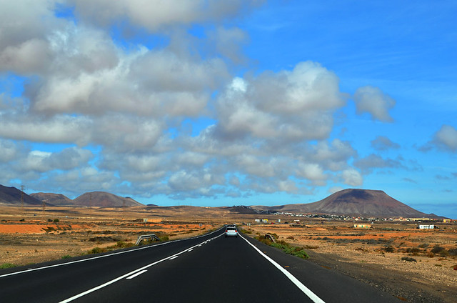
Fuerteventura might be the second largest of the Canary Islands but we found it was easier and quicker to drive around than the likes of La Gomera, the second smallest, where travelling six miles as the crow flies can take over half an hour by road. The coast road north was straight and quiet, there are more goats than people, and a joy to drive. Fuerteventura’s version of Ayer’s Rock added interest along the way, changing colours with the movement of the sun. Road signs warning of leaping deer brought smiles. There aren’t any leaping deer, they couldn’t get hold of goat signs.
The Dunes at Corralejo
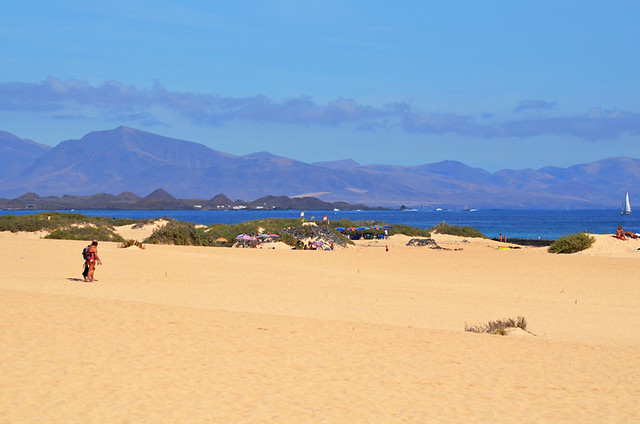
We knew Fuerteventura was famous for its endless sandy beaches but WOW, we had no idea how endless they were. Somewhere we’d taken a wrong turn and had ended up in the Sahara. The area around Corralejo is an ocean of white sand. When you step onto the dunes a few things strike you. The first is that they are so epic they swallow crowds up. The second is they are so expansive there’s a fear of getting lost in them. And the third is that it’s almost impossible to take a photo without catching a bare bottom in the shot.
Corralejo

Our first impression of Corralejo was that it was disappointing compared to the landscape surrounding it. It seemed a characterless bland sprawl of unattractive bars and restaurants, many with cheesy names. We knew there was an old town at the harbour so made a bee line straight for it. Turns out Corralejo is a town of two halves. The area around the harbour feels Canarian with whitewashed buildings lining narrow streets, the odd windmill and a mix of casual and cool surfer bars and traditional restaurants. It simply exudes a totally different vibe. Even the people who stroll the streets there look different from those in the newer part of town. It’s almost as if there’s an invisible barrier seperating the two.
Tapas of churros de pescado (fried cubes of fish) with a light and lemony garlic mayonnaise and cochino frito (fried pork) at Oscars set us up for an afternoon of more exploring.
El Cotillo
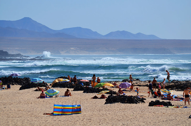
A relatively short drive took us from Corralejo to El Cotillo on the north west coast and more golden sand beaches where it really is impossible to take a photo that doesn’t include some guy standing, hands on hips, letting it all hang out. The waves there are relentlessly fierce. It’s easy to see why Fuerteventura draws surf dudes from across the globe.
Faro del Tostón
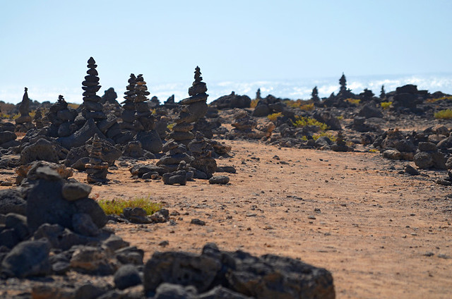
Just along the coast we found the Faro del Tostón, a lighthouse turned into a museum of fishing. All around the lighthouse little towering rock sculptures mirrored the faro, adding a pleasing balance to the scene.
La Oliva
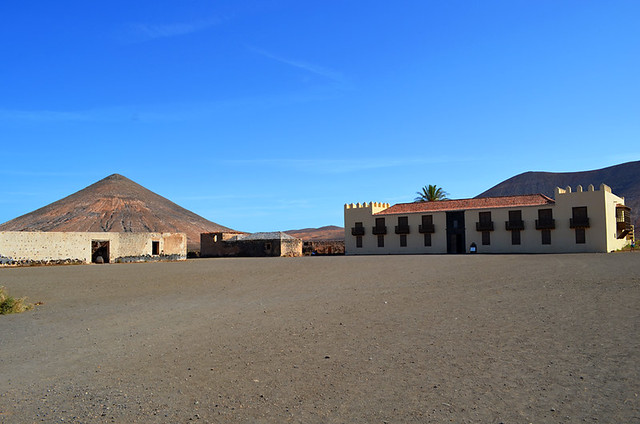
The road inland skirted fields of thirsty looking aloe vera to La Oliva, an historic town dating back to 1500 when there were two cottages there. There are a few more buildings around now, including the 18th century Iglesia de Nuestra Señora de Candelaria and the 17th century Casa de los Coroneles where Fuerteventura’s military governors resided. It’s claimed the house has over 365 windows. As they were shuttered we couldn’t check. It’s more likely this was a way of pointing out that it was an important place – ‘there are more windows than days of the year’.
Orange County
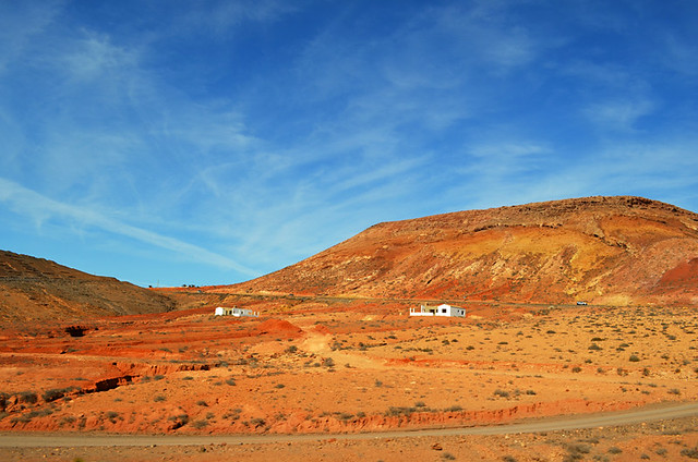
The homeward trip from La Oliva back to our hotel, the Elba Palace, meandered through a treeless and hypnotic volcanic landscape that included soulful Tindaya; a sacred mountain to the island’s original inhabitants. The odd thing about Tindaya is that it has carvings of what looks like pairs of feet on its west facing slope. Historians have surmised that the feet were etched on the western slope to face the mountain where a devil lived, Mount Teide on Tenerife.
The journey also took us through some of the most vibrantly orange countryside I’ve ever seen.
There had been beautiful beaches galore as expected but there were also other qualities, enough to convince us Fuerteventura had a personality which extended beyond being a haven for sunseeking visitors.
Another day would bring further proof and our first sighting of the skweerels.
Jack is co-owner, writer and photographer for BuzzTrips and the Real Tenerife series of travel websites as well as a contributor to lots of other places. Follow Jack on Google+


Be the first to comment